Visitor Map
11” x 8.5” (27.9 cm x 21.6 cm)
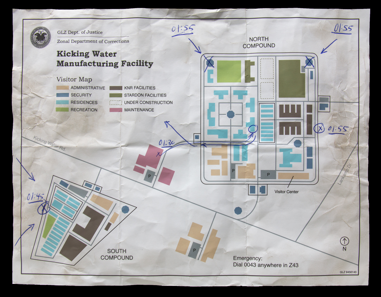
The map seen here may hold the key to understanding Jarndyke’s final hours. Scholars believe that Jarndyke may have been involved in an assault at the Kicking Water Manufacturing Facility, a prison complex that utilized inmate labor on behalf of Zone corporations. Across the GLZ, compounds such as this one exploited free labor for corporations such as Stardon and others.a
Both petty criminals and political dissidents were typically housed in facilities like this one. The presence of the latter at Kicking Water may explain the planning seen on the map, which appears to plot a breach and escape.
As this document appears to be the last along Jarndyke’s route north through the GLZ, scholars assume he was either captured or killed during this action.b
a Oestreicher NL. Assessing the role of manufacturing penitentiaries in the Zones. Proceedings of the American Arkology Society. 2011. 82(1);17-23.
b Those lost and those found: Matthew Jarndyke’s final days. Liminal. 2013. 42;114-119.